Do you know your cloud types?
Do you know your cloud types?
White and fluffy or filmy and thin, clouds can be fascinating. The visible masses of condensed vapor particles suspended in the atmosphere, characterized by weather patterns and atmospheric activities, have up to 100 different names, and are distinct in their shapes and sizes. They can be the backdrop to a beautiful day or the forewarnings of incoming storms.
Knowing the different types of clouds can be essential whether you're planning a picnic or studying for a test on weather. Using the 2017 International Cloud Atlas (World Meteorological Organization), Stacker put together this quiz on 12 recognized clouds. The odd-numbered slides have a photo and title, and the even-numbered slides identify the cloud type and provide details such as how the clouds form, their significant characteristics, and in what part of the atmosphere they're found.
Here, find out why some clouds look like colossal cotton balls while others resemble flying saucers. You also can learn why clouds have specific names, most often derived from the Latin; the roots and translations help to classify their components. For instance, cirro means curl of hair and high; alto means mid-level; strato means layer; nimbo means rain or precipitation; and cumulo means heap. Add on that clouds form in one of four ways—surface heating, air encountering a mountain range, cold or warm weather fronts, and air masses forced to rise—and, well, you'll find there's a lot to learn about clouds.
Read on to check out the quiz on 12 types of common clouds.
You may also like: 50 ways the weather could change in the next 50 years
Cloud type #1
Cumulus
With sharp, puffy outlines and a flat base, cumulus clouds seemingly transform into all sorts of images. While “sometimes they look like sheep grazing in a pasture,” according to the website Windows to the universe, cumulus clouds, which are found below 6,500 feet, can be signs of rain or continued sun, unlike other clouds that appear solely when rain is ahead.
Cloud type #2
Altocumulus
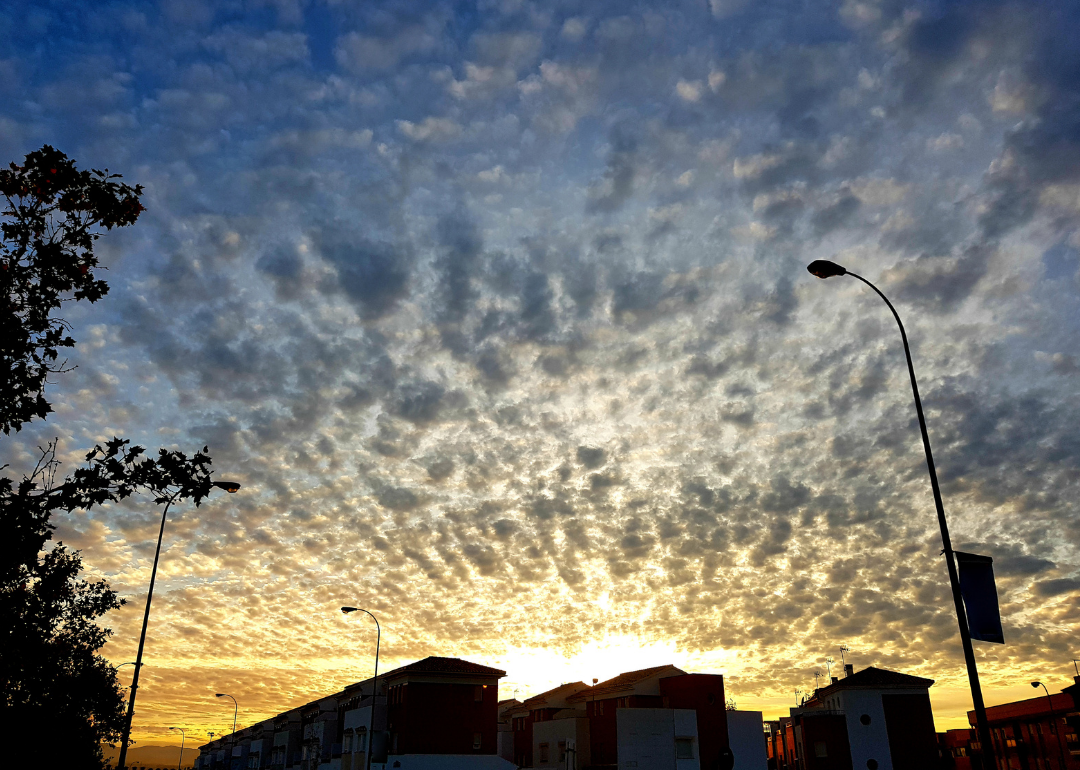
A middle-altitude altocumulus cloud can be likened to a cropped field in the sky, with parallel bands of large and small puffy masses lining the horizon. Made up of cold, tiny water droplets, and found at elevations of between 6,500 and 22,000 feet, altocumulus clouds signal a high risk of afternoon thunderstorms despite a clear, bright blue backdrop. These clouds can also take on a disc-like shape, so they sometimes mistaken as Unidentified Flying Objects or flying saucers when seen above mountaintops.
Cloud type #3
Noctilucent
Noctilucent clouds are just as they sound, night-shining masses of silver-blue that blanket the sky at twilight or before sunrise. As the highest clouds found in the Earth's upper mesosphere—as far as 50 miles from the Earth's surface—noctilucent clouds usually appear in May through August in the Northern Hemisphere. “You actually get the coldest temperatures of the year near the poles in summer at that height in the mesosphere,” according to EarthSky, which notes that noctilucent only form in incredibly low temperatures when water can turns into ice crystals.
Cloud type #4
Stratus
Of all clouds, the low-level stratus has no depth or shape. The name stratus, which means layer in Latin, rightly describes the hazy, gray mass that blankets the sky. This type of cloud, which is related to fog, hangs in a formless mass in stable weather conditions. Stratus clouds can loom for days, hiding the sun but never dropping heavy rain, though they also can provide a slight mist or drizzle, and sometimes snowflakes.
Cloud type #5
Cirrocumulus
The name of the cirrocumulus cloud originates from the Latin and means wispy, and is defined by its shape of bunched strands. Cirrocumulus clouds, made up of ice crystals and supercooled water (the temperature of water below its freezing point), tend to look like clumped hair. When numerous cirrocumulus clouds cover a vast section of the sky, they appear like fish scales, which is why they sometimes make up what is known as a "mackerel sky.” While most often seen in cold and fair weather, rippling lines of cirrocumulus clouds coming from the west can mean rain within the next 48 hours.
Cloud type #6
Altostratus
Dark and spread out, the bluish-gray, mid-level altostratus cloud, which hangs anywhere between 6,500 and 20,000 feet in the atmosphere, usually indicates a warm front. The clouds, created by droplets of water, change in color depending on how much water they hold. A vast set of altostratus clouds covering most of the sky usually means continuous rain or snowstorms are soon ahead.
Cloud type #7
Cumulonimbus
Considered the most massive cloud, a cumulonimbus can create bad lightning and is usually a sign of upcoming severe thunderstorms. Also associated with tornadoes, cumulonimbus clouds, which are dense, vertical, and towering, are considered anvil clouds, meaning they have a flat top most often caused by high winds. Though these clouds form under 20,000 feet, the top of one can reach 39,000 feet or higher in the sky. In certain weather conditions, a supercell, which creates revolving thunderstorms because of a rotating updraft, can occur in the mature stage of a cumulonimbus.
Cloud type #8
Cirrostratus
The sheet-like, high-level cloud called a cirrostratus can be difficult to detect. With the sun or moon shining through this type of cloud, which hang above 20,000 feet, it can appear as a halo in the sky. Most often formed from a warm front, when a mass of air moves above warmer air, a cirrostratus also can be created by jet streaks, faster-moving air inside a jet stream. The cirrostratus cloud also has another unusual effect called a sundog. “When the ice crystals in cirrostratus clouds uniformly align, sunlight reflection may create a rainbow effect on opposite sides of the sun,” according to the website Sciencing.
Cloud type #9
Nacreous
Nacre means "mother of pearl," which explains the description of the clouds that resemble the iridescent color of a mollusk shell's inner layer. Nacreous clouds, also called ice polar stratospheric clouds, are formed at high altitudes below the frost point in the winter months. The cloud's parallel bands of pink and green, which occur from the diffraction and interference of light waves, cause a canvas of colorful pearlescent puffs in the sky that is both “stunningly beautiful and surprisingly destructive,” notes the Weather Channel, which details how nacreous clouds can cause holes in the ozone layer.
Cloud type #10
Stratocumulus
Derived from the Latin word meaning flattened out, a stratocumulus cloud is spread out in a layer of low, gray, and puffy clouds usually separated by patches of blue sky. If the pieces of blue extend in a sheet across a sky filled with stratocumulus clouds, weather conditions could become significantly better, but a more mosaic pattern of thin spots could mean the weather is slowly transitioning to improvement. Usually below 6,500 feet, with a maximum altitude of 8,000 feet, stratocumulus clouds can also appear in a row, and on occasion produce light rain or drizzle.
Cloud type #11
Cirrus
Higher than 20,000 feet, cirrus clouds are thin and wispy and form not only on Earth, but also on Mars, Saturn, Jupiter, and Uranus. Though cirrus clouds usually indicate fair weather, they also can develop in the eyewall, the worst part of a hurricane. A 2013 report on the Live Science website details how humans can create cirrus clouds through land-use changes and industrialization, and that such clouds “have about 10 times the impact on climate that man-made greenhouse-gas emissions do.”
Cloud type #12
Nimbostratus
If there is heavy rain or snow, there is likely a nimbostratus cloud above. The dark, low-level cloud can hang as low as one mile (5,280 feet) above Earth's surface. While a nimbostratus produces heavy precipitation, it does not create lightning or thunder. This type of cloud is often vast, with no seen edges, and fills up the sky during heavy rain or snow storms. With no clearly defined shape, the dense, dark layers of a nimbostratus can be hard to spot.